NASAs Perseverance Rover Captures Stunning Images Of Mars In Never Before Seen Detail
These astonishingly detailed images of the surface of Mars were captured by NASA’s Perseverance Rover, which has now spent 217 Earth days scouring the red planet’s surface as it searches for signs of ancient life.
NASA’s Perseverance Rover has been exploring the Jezero Crater for over 217 Earth days (211 Martian days), sending high-definition images back to Earth as it tries to piece together billions of years of Martian history.
According to a statement made by NASA, “the rover used its seven powerful science cameras to capture the images of the rugged surface of the Jezero Crater, which is believed to have once been home to an ancient lake.”

The cameras have the ability to focus on tiny details from a huge distance, allowing researchers to identify rock samples that may be useful in their hunt for evidence of life on the Red Planet.
Vivian Sun, the co-lead for Perseverance’s first science campaign at NASA’s Jet Propulsion Laboratory in Southern California, said: “The imaging cameras are a huge piece of everything,”
Sun added: “We use a lot of them every single day for science. They’re absolutely mission-critical.”
The statement revealed more details about how the Rover’s cutting edge cameras help it to navigate and send images back to our planet.
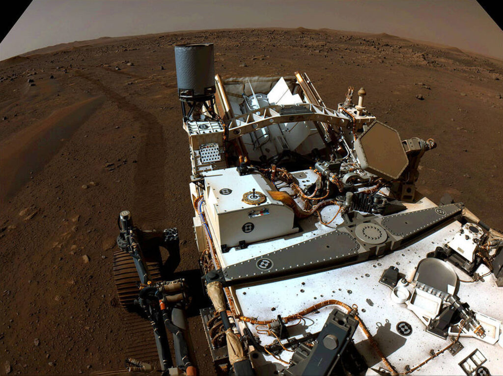
The Rover’s two navigation cameras support its autonomous driving system, and every time the rover stops, these two cameras record a 360-degree view to provide a lay of the land.
Perseverance has six hazard avoidance cameras, or Hazcams, including two pairs in front which help the Rover to avoid dangerous situations and allows its robotic arms to lock onto targets.
Sun said: “The navigation camera data is really useful to have those images to do a targeted science follow-up with higher-resolution instruments such as SuperCam and Mastcam-Z.”
The SuperCam is used to study the planet’s chemistry, allowing the researchers to hunt for signs of ancient microbial life.
It has a Remote Micro-Imager, or RMI, which is able to zoom in on features smaller than a football from over half a mile away.
Roger Wiens, principal investigator for SuperCam at Los Alamos National Laboratory in New Mexico, explained that the images captured by SuperCam have revealed countless stories about the planet’s past.
He said images captured of huge boulders show that “there had to have been some huge flash flooding that occurred that washed boulders down the riverbed into this delta formation.”
Wiens said: “If the lakebed was full, you would find these (boulders) at the very top. So the lake wasn’t full at the time the flash flood happened.”
He added: “Overall, it may be indicating an unstable climate. Perhaps we didn’t always have this very placid, calm, habitable place that we might have liked for raising some micro-organisms.”
The cameras have also picked up on signs of igneous rock that formed from lava or magma on the crater floor during this early period.
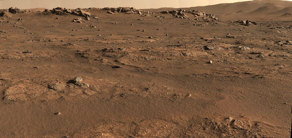
This suggests that not only was there flowing water on the planet but flowing lava before, during, or after the ancient lake was formed.
The Mastcam-Z, a pair of “eyes”, is equipped with a powerful zoom features and the ability to capture detailed 3D images, panoramic shots and record high-definition videos.
Jim Bell at Arizona State University, who leads the Mastcam-Z team, said: “We can swing through vast swaths of real estate and do some quick assessment of geology, of colour. That has been helping the team figure out where to target instruments.”
The Rover’s ability to capture colour allows NASA to make links between features seen from orbit by the Mars Reconnaissance Orbiter (MRO) and what the rover sees on the planet’s surface.
According to NASA: “The camera also functions as a low-resolution spectrometer, splitting the light it captures into 11 different colours, which scientists can then use to determine the composition of the mineral reflecting the light. “
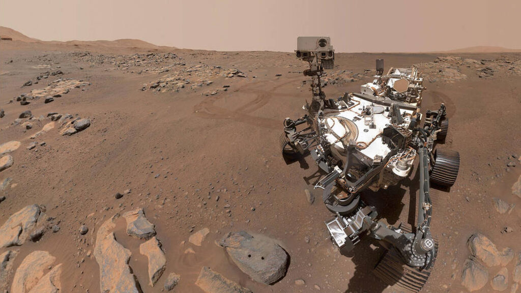
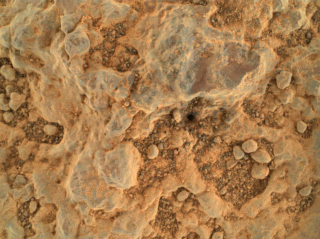
The WATSON (Wide Angle Topographic Sensor for Operations and Engineering) snaps extreme closeups of rock and sediment, zeroing in on the variety, size, shape, and colour of tiny grains, allowing scientists to identify useful samples.
The samples can then be extracted and one day potentially returned to Earth for analysis.
The images captured by the Rover’s cameras provide crucial clues in NASA’s search for signs of ancient Martian life.


